Comparing DEM and DSM in Rooftop Solar Evaluation
- Category: GIS
- Purpose: GIS Class Final Project
- Project date: May 2021
- Interactive Web App: ArcGIS Online
- Slide Deck: Slides
- Research Paper: Documentation
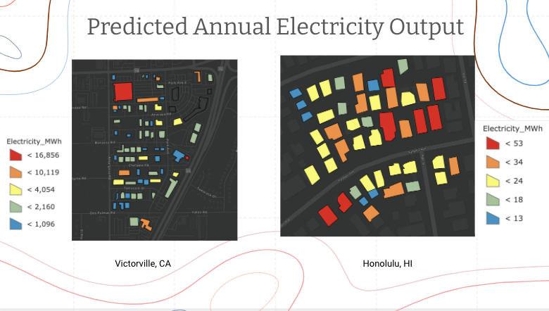
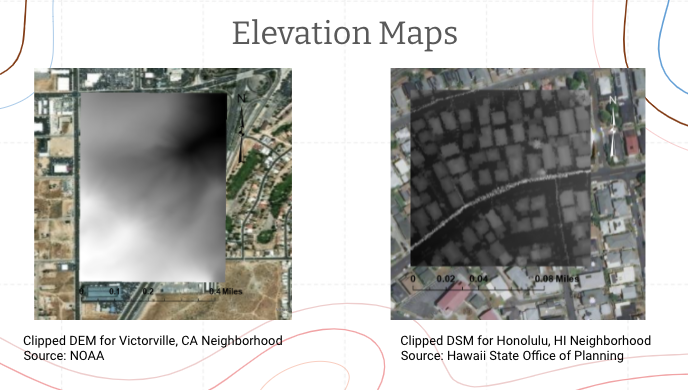
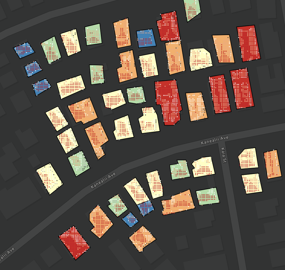
I used my GIS class Final Project to explore something near and dear to my heart: renewable energy (and its optimization). Here I examine two types of LiDar data: DEM (Digital Elevation Model) and DSM (Digital Surface Model). DEM reaches ground level whereas DSM is associated with the tallest reflection feature -- and can thus capture the intricacies of individual rooftops.
I compare the efficacy of using the different LiDAR data on evaluating a rooftop's potential solar energy capture by performing Solar Analyst Tools in ArcGIS. I was able to predict the annual electrical output of a handful of rooftops in both Honolulu, HI and Victorville, CA.